Ridge-lines, Rivers and Roads

“You can’t stop the waves. But you can learn to surf” 

Jon Kabat-Zinn

Day 8 – 12

  • Day 8 – Whangaruru to Helena Bay ; 18 km
  • Day 9 – Helena Bay to Whananaki North ; 28 km
  • Day 10 – Whananaki North to Ngunguru ; 27 km
  • Day 11 – Ngunguru to Ocean Beach ; 32 km
  • Day 12 – Ocean Beach to Whāngārei Heads ; 15 km

Total hiked: 300 km


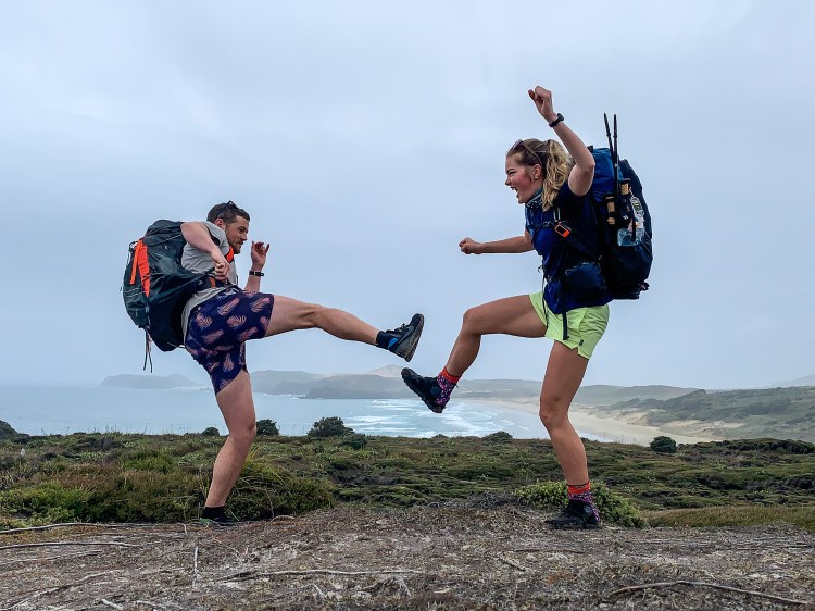
Starting the next few days walk towards Whāngārei I was apprehensively excited.

A lot of firsts for me in terms of hiking were going to take place and the anticipation was …. well you’ll find out in this blog post.

Following a day of scorching sun and road walking to Whangaruru, I rose, packed away my tent and set off from The Farm bright and early to start my road walking adventure again. The road walk today involved less busy roads and less distance, which after yesterday I was very appreciative of.

First day with my hiking poles is it obvious?

Along the way I took multiple stops, aimlessly sitting on the side of the road, waving at every truck that drove past me, chatting to locals as I trotted through their (very small) towns, kindly declining every offer of a ride (this was hard) and eating a lot of dry noodles which may have resulted in a trail of noodle seasoning in my wake.

Early afternoon I made my way into the beautiful Helena Bay and decided to stay with the lovely trail angels Dave and Alex and their adorable animals Kōwhai, Toto and Jack. They provided a caravan for me to sleep in overnight, cooked a delicious roast chicken dinner and told me wonderful stories of how they met, the multitude places they’ve lived in NZ and the many TA hikers they have housed over the years. Alex is a painter and has an art studio in Helena Bay which Dave is in the process of expanding an outside gallery for her to display her work in. They are two caring and incredible people and I highly recommend anyone who walks TA to stay with them!

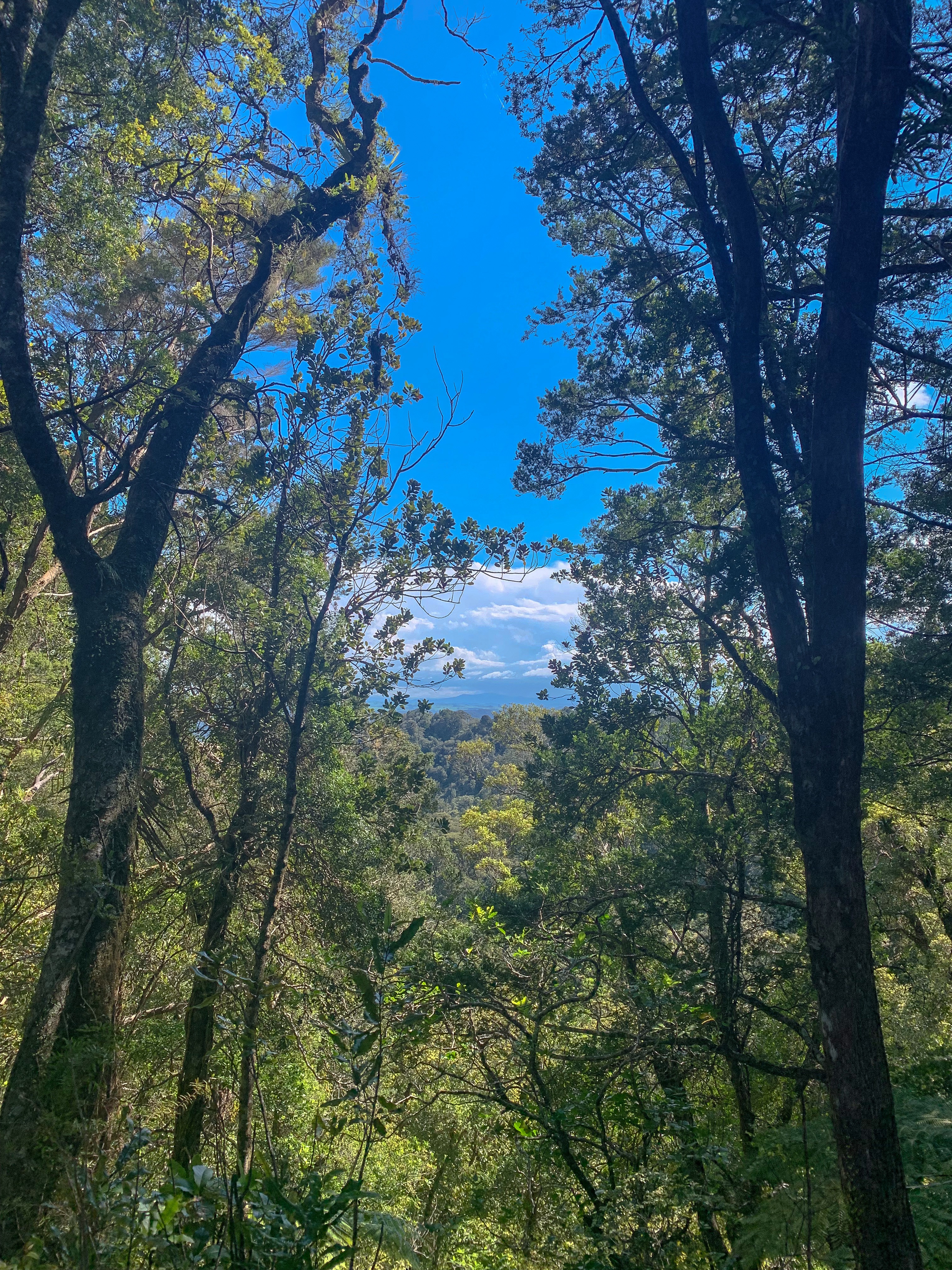
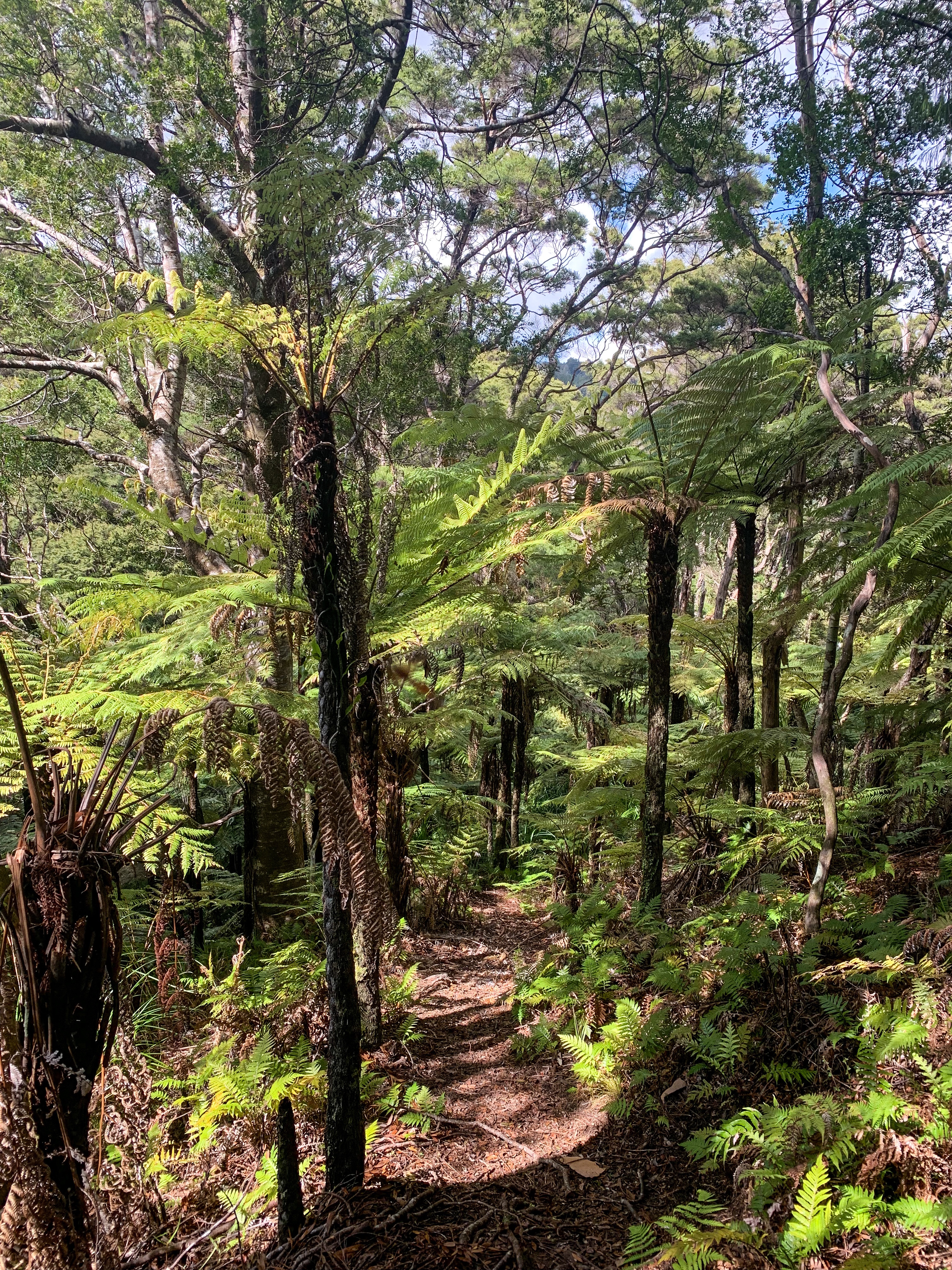
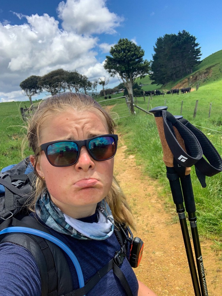
The next day proved long and then even longer. After getting up early once again to start the Helena Ridge Track (I am not a morning person), I found the great intentions I had of beating the afternoon sun fail as I got lost several times on this ridge-line. What is probably a very well marked track if you can stay on it turned into total bush whacking; attempting to jump over fallen tree trunks, slipping down the hill, fighting every spiderweb in the forest and hidden 30 cm holes as I struggled through.

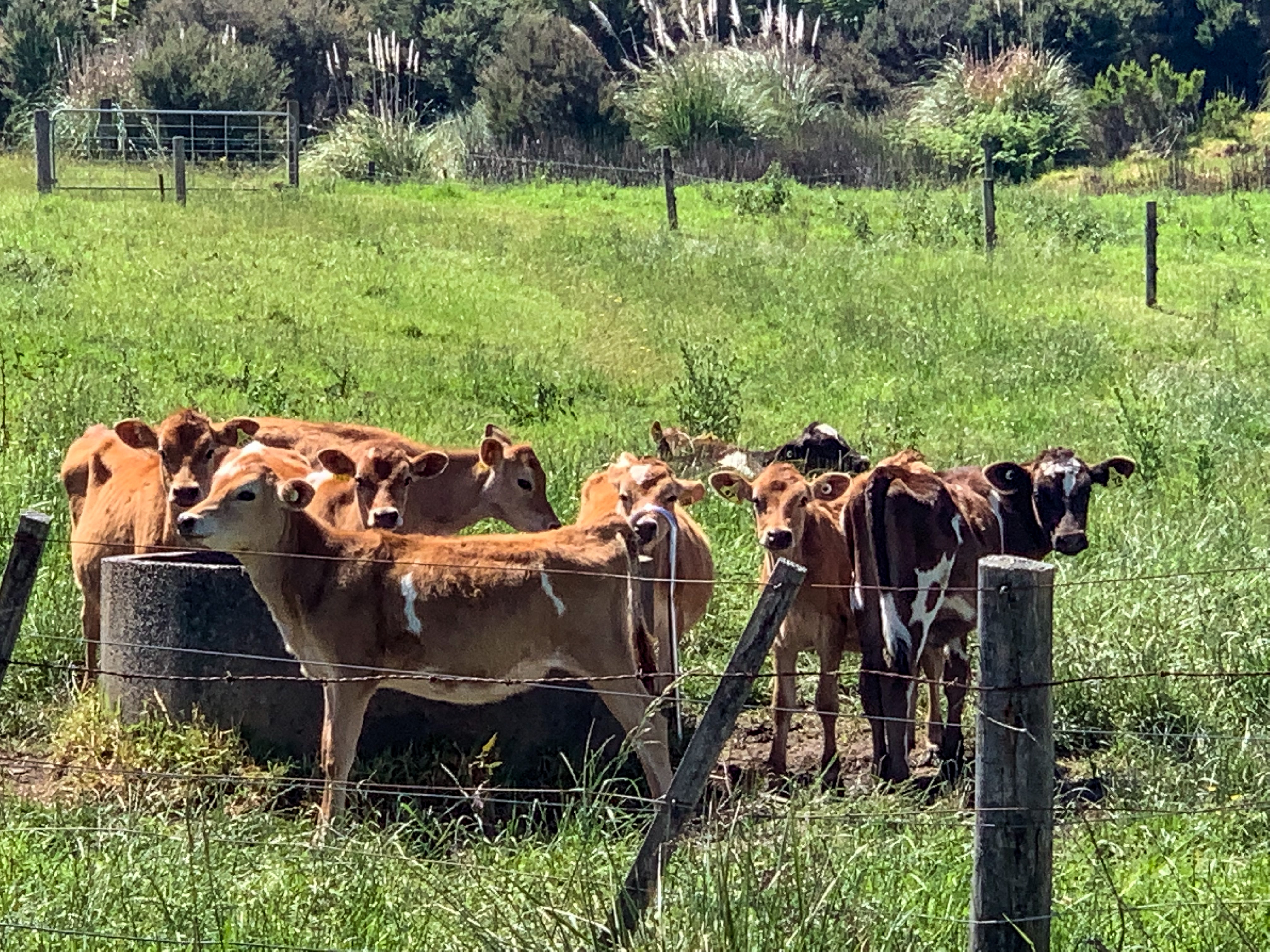
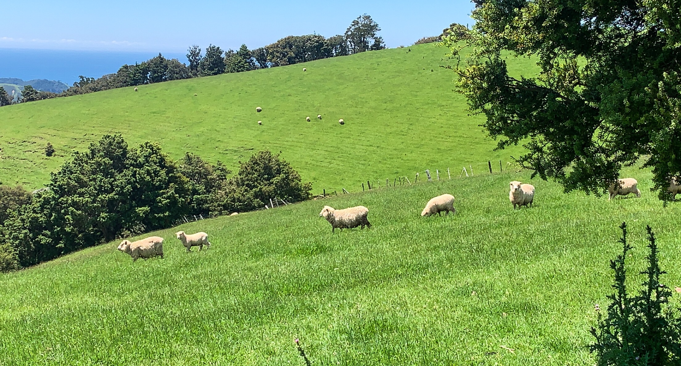
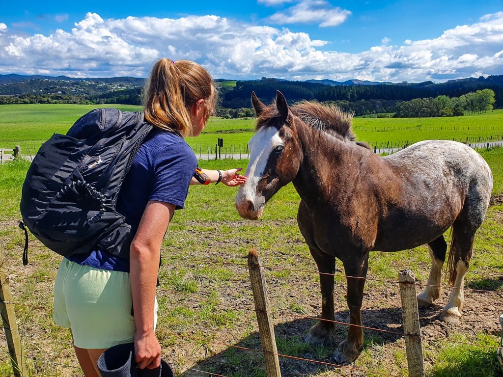
To make matters worse, part way through the track you pass through farm land which involved walking THROUGH the cow paddock. Up until now I have only walked alongside the cows never in the field with them. This was and who am I kidding still is a fear.

As I approached the fence line of the cow paddock they as usual all began walking towards the barrier, mooing to their hearts content. Not comforting. After walking up and down the fence line confirming the only passable route was through their paddock I did what any normal person would do and made a few upset phone calls to family/friends expressing my cow concerns, praying for a miracle and finally as a very 21st century solution fixer, I googled “how to walk through a paddock of cows” (this really should be in the trail notes). Following none of this advice I set about my master plan! I lured all the cows to the top of the hill along their fence line, waited until they ALL made it to the top (this took a while) then hastily ran back down the hill, across the electric fence, through the paddock and jumped over the stile. All with my hiking poles facing outwards to provide a 120cm buffer zone should a cow catch me in my sprint.  Only when across the stile did I turn back to see a few cows a couple of metres behind me.

My feelings towards the cow paddock 😦

Alex 1 : Cows 0. I may need a better cow paddock crossing strategy before I get to Waikato.

When I finally made it out the other end of the track I was greeted with the sad reality of bypasses (a common theme this TA season). Unfortunately due to further Kauri die back concerns and private land sales, what used to be the bush route of Morepork-Onekainga track leading into Whananaki North was now a dirt and asphalt road bypass of 18km, yup 18km! This felt like deja vu from two days ago. Nonetheless I set about turning right towards the bypass route, started a new audiobook and began my trot.

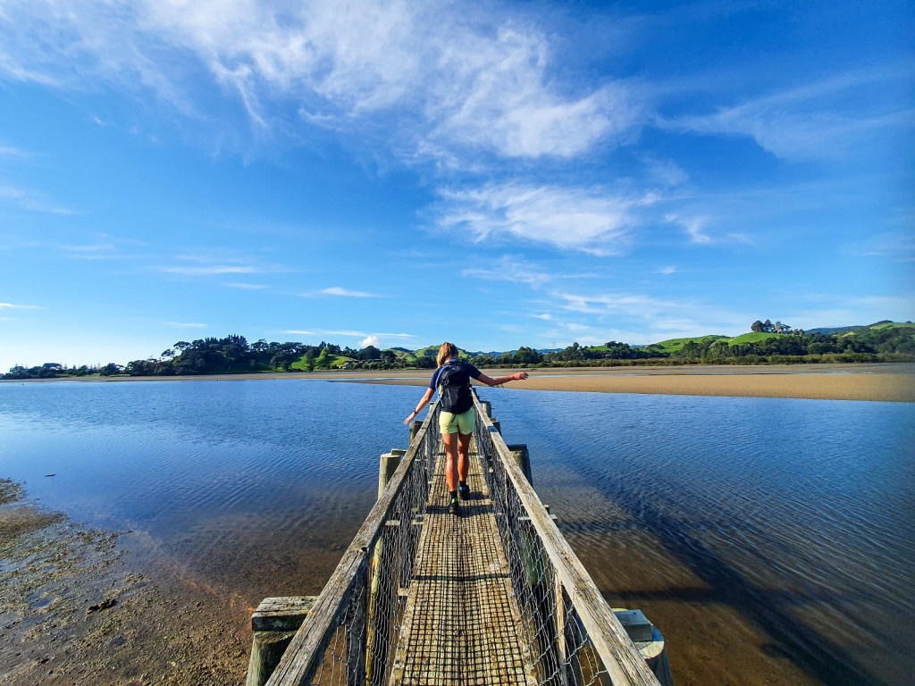
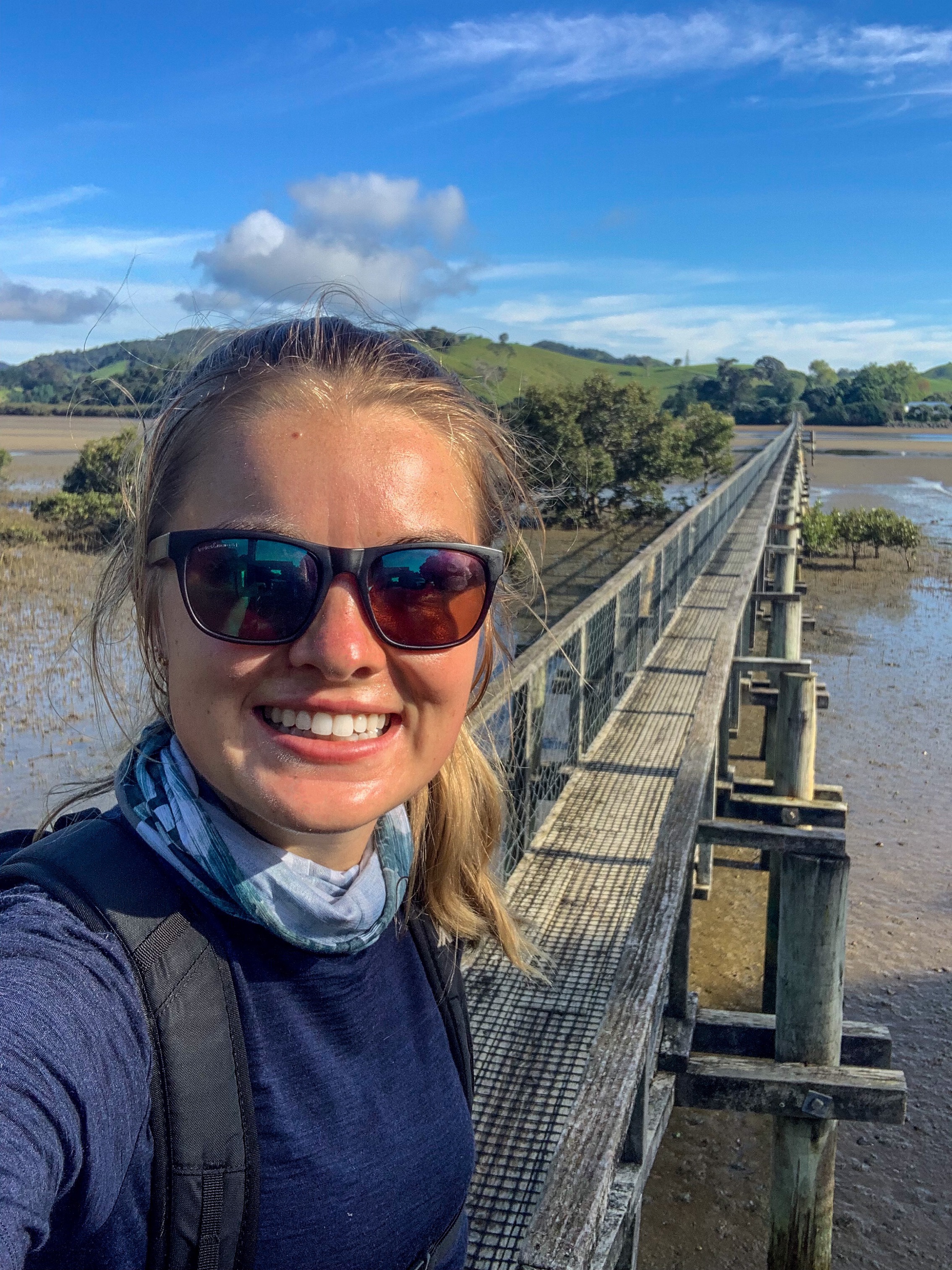
The following morning I awoke with Britney Spears/Spice Girls level excitement (or maybe childhood Christmas excitement is more relatable) for the bridge ahead. 

Whananaki footbridge

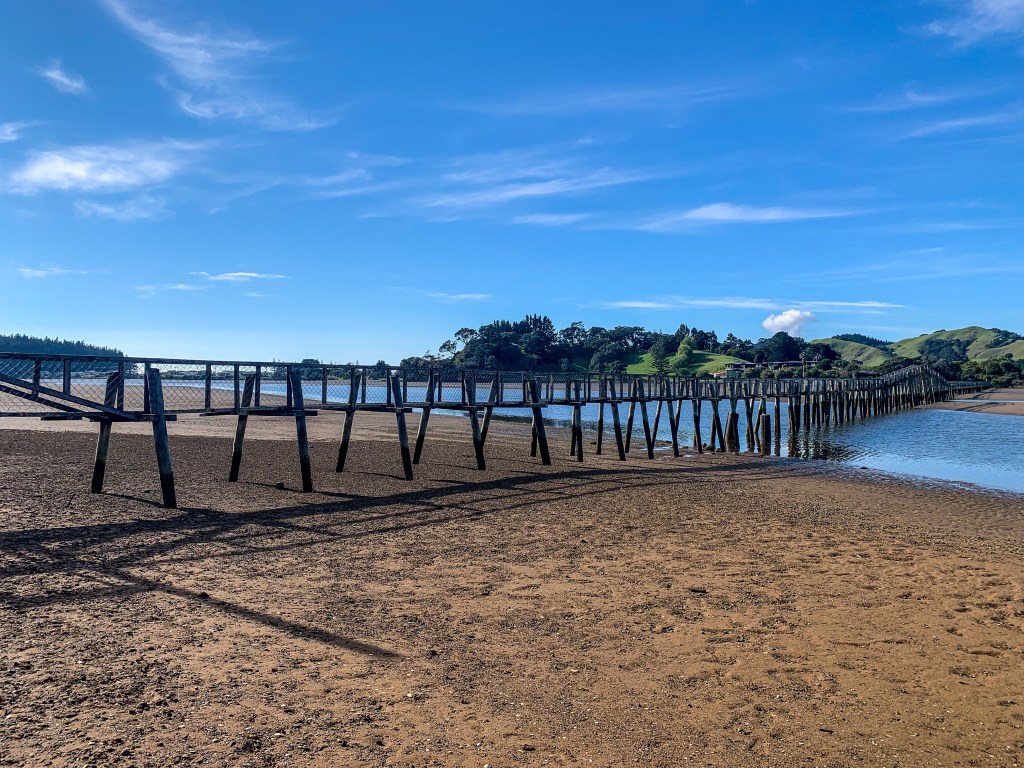
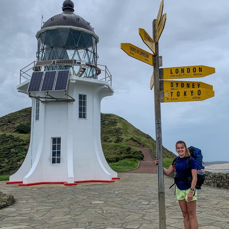
In the North Island there are two things I am really looking forward to ; the 141m tall Maramataha suspension bridge (lets be honest all 35 of the Timber Trail bridges sound pretty awesome) and what I would be crossing today, the Whananaki footbridge.

This is the longest footbridge in the Southern Hemisphere, constructed in 1947 it connects Whananaki North to South and provides access for primary school students in the south to attend school in the north. Prior to this teachers used to row students across the river.

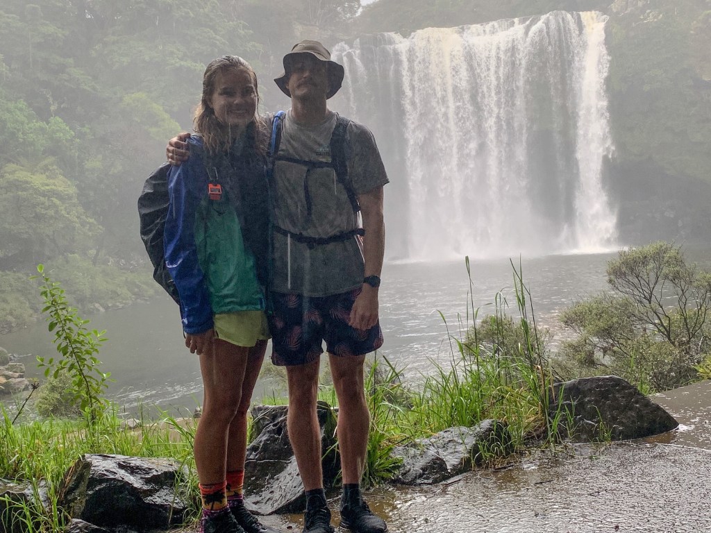
And to make matters even better, Nate joined me for this exciting morning crossing (well half of it at least).

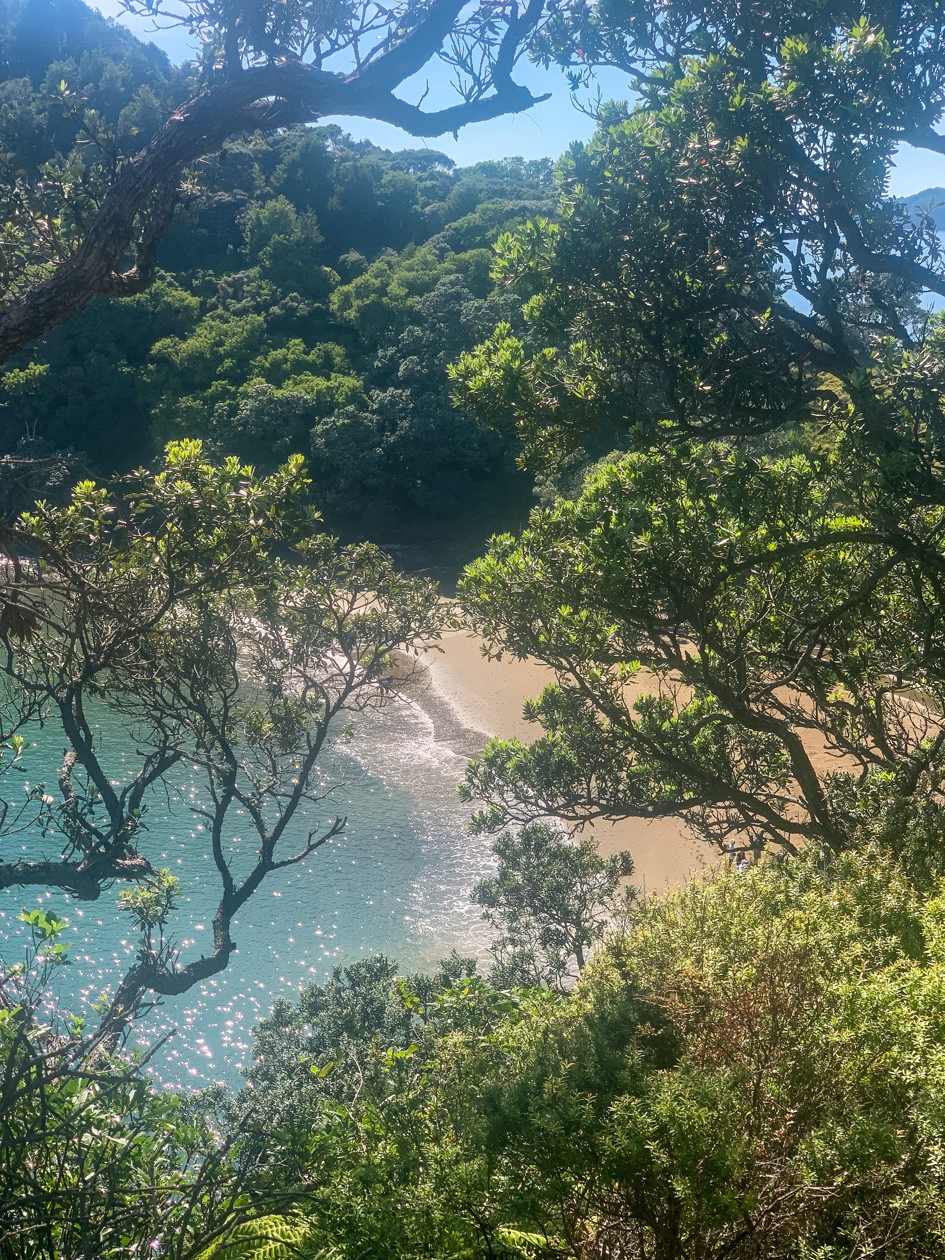
After the bridge crossing I joined the Whananaki Costal track and happily frolicked my way around the stunning costal line to Sandy Bay.

So excited to be on this bridge!
Chuffed 🙂

Having completed the coastal track previously, I spent most the time reminiscing about the footbridge crossing and managed to smash it out in 90 minutes. TA trail from Sandy Bay has changed from previous seasons and now due to further private land sales there is of course another road bypass, though this one wasn’t nearly as bad as yesterdays. After an initial slog up a hill, the route meanders to the start of the Old Coach Trail and then down to Ngunguru. Maybe it was the earlier bridge crossing, my audiobook choice or the rum n raisin ice cream I had at lunch but I actually really enjoyed this road walk.

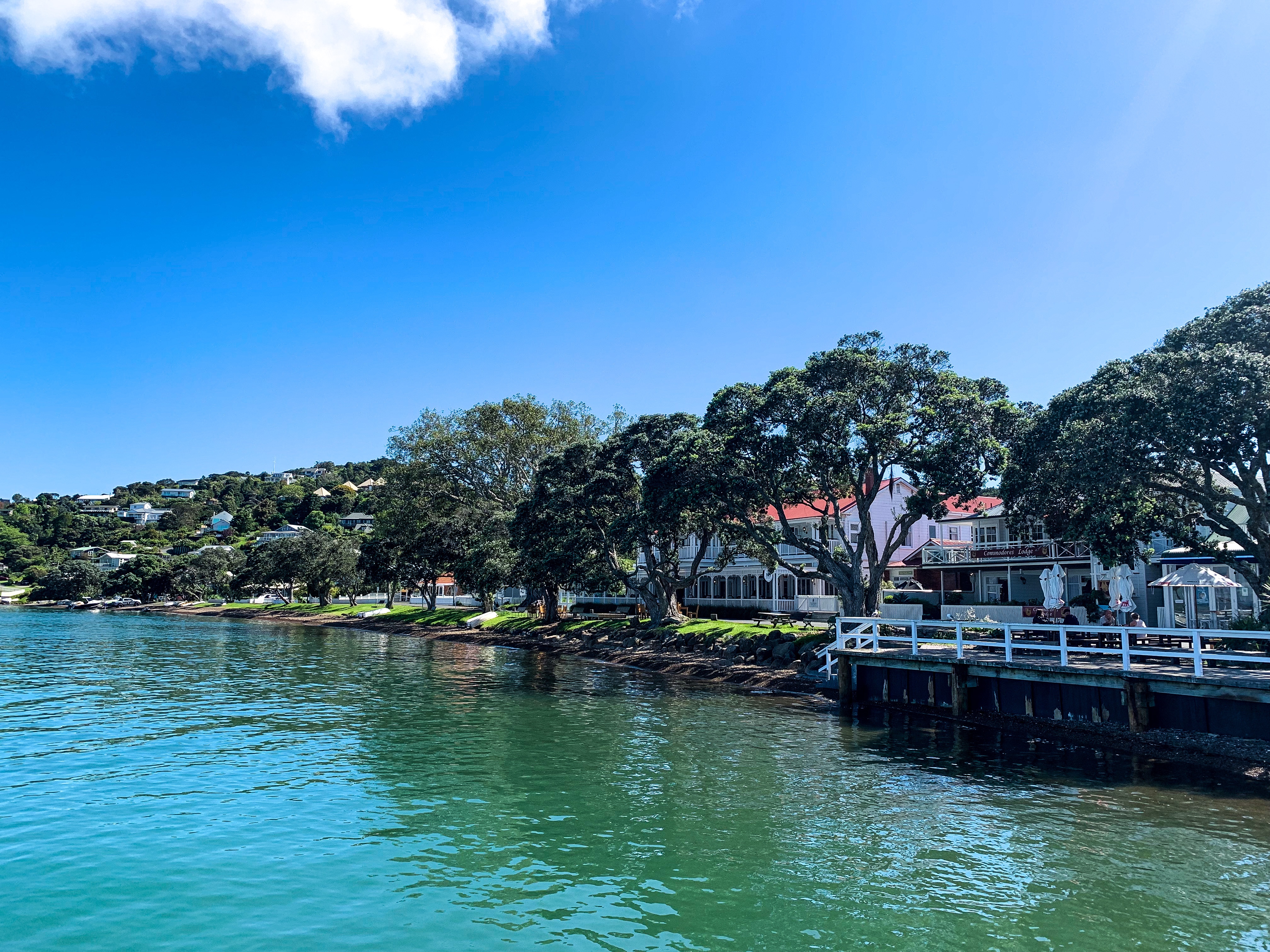
In Ngunguru I stayed with my former boss Mike, his lovely wife Erin and their very friendly and chatty sons Cuchulainn, Seamus and Fionn. Not only did they feed, shower and house me for the evening which was brilliant but Erin gave me great book recommendations and life advice that I’m always in need of!!! Mike, Cuchulainn and I also strategised the following days river crossings and raft adventure.

Unfortunately, what we realised a little too late when I awoke at 0600 the following morning for a 0700 start was that we were an hour off on the tide times in Ngunguru, meaning a plan of crossing the first river before the tide was at its lowest was actually going to be after the fact and make the next crossing a little sketchy. Regardless, first thing Thursday morning Mike, Cuchulainn and I set off from Ngunguru around the sand-spit and into Wharewa Bay on his raft for my first ever river crossing. Either my apprehension was palpable or I looked utterly incompetent but when we beached the raft in the bay without a trail in sight, Mike ever so kindly offered to walk to the river with me which entailed fighting through gorse bush up and over a hill to Horahora River. With a few more scratches and scrapes Mike and Cuchulainn bid me farewell as they left the bay just in time for my river crossing. 

Horahora River, usually the first river crossing for SOBO hikers is known as being the more sedate or gentler crossing in comparison to Taiharuru River located 13.7km further down the trail. Taiharuru River with its surrounding sand banks, rocky point and copious mangrove beds is supposed to be the crossing where walkers get wet, muddy and covered in mangrove sludge. This wasn’t the case for me.

Horahora River

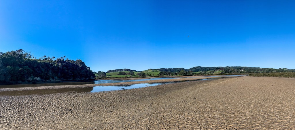
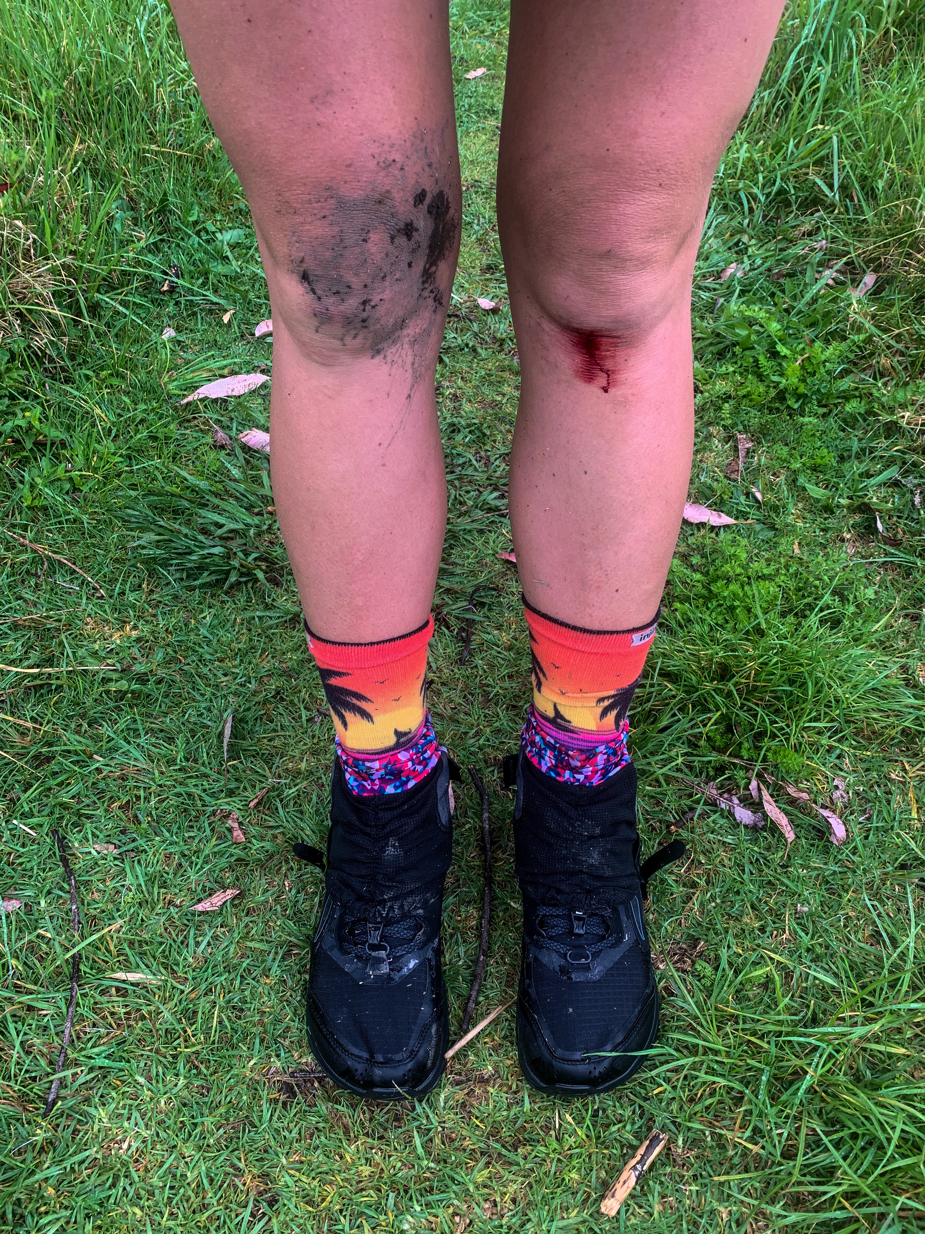
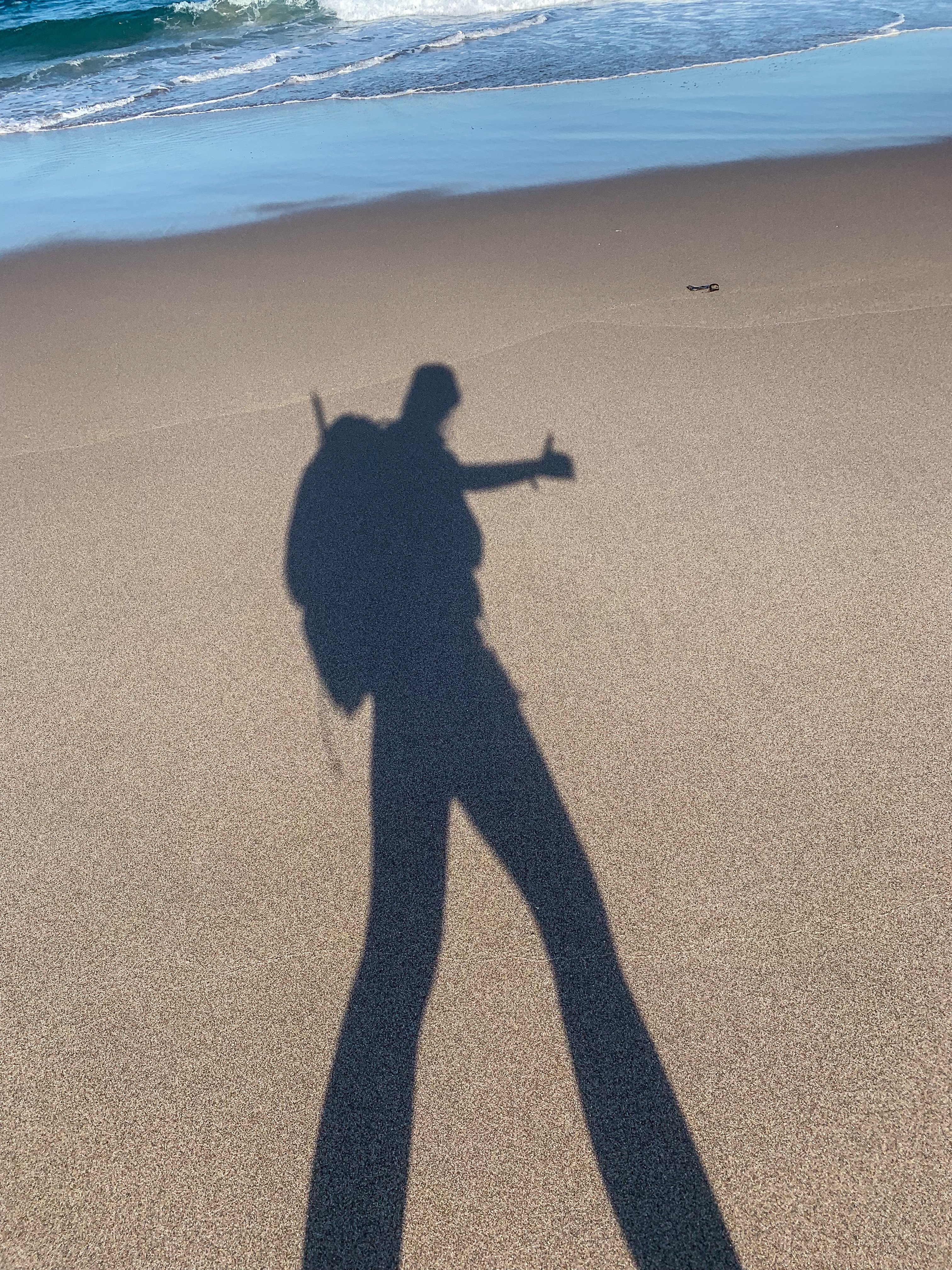
I approached Horahora River in my sandals (always have to protect the soles of my feet from goodness knows what’s beneath) with an “I can do this” attitude and knowing this river was supposed to be the easier of the two. Well thats where the positivity stopped. With a wide stance, waddling gait and standing perpendicular to the current I crossed the river pretty uneventfully. At its highest the water level got to my knees (I am a long-limbed human) and I made it safely across. My elation was short lived when I realised the trail to follow alongside the fence line was packed with mangrove mud, roots and cutty grass (or carex geminata if you would like a specific name for the plant I hate). Every step through the mangrove mud my sandals would sink deeper and deeper below, the velcro would tear as I took every step, at some points loosing a sandal to only go through this process again 4-5 steps later. The mud continued to advance higher and higher up my legs, eventually making its way mid-shins and flicking dollops up my thighs and pants. At one point, concerned I was sinking too deep into the mangrove mud I leant sideways and lost balance, falling onto the fence line and ALL THE CUTTY GRASS. Trying to correct my stance and stand upright again I cut my fingers, palms, face and legs on the plant and began bleeding through the mud stains. By the time I made it out and onto the road side, I had lost over a hour in what should have been a 10-15 minute crossing, stunk of mangrove mud and had dirty cuts everywhere. When I updated Mike of my progress he reassured me I had at least 3-5 days until sepsis kicked in 🙂 After licking my wounds I promptly hit the road as I still had 13.7km to the next river to do this all over again.

Pātaua footbridge
Much needed sugary treat 🙂

By the time I made it Pātaua North and crossed the bridge to Pātaua South, the tide was definitely flowing inland and my hopes of making the next river in time had all but vanished. Instead of feeling too disappointed I felt proud that I had crossed my first ever river. I cleaned myself up in Pātaua and ate one of the freshly baked cookies that Erin and Fionn had made the night before (thanks again, they really boosted my mood and tasted delicious).

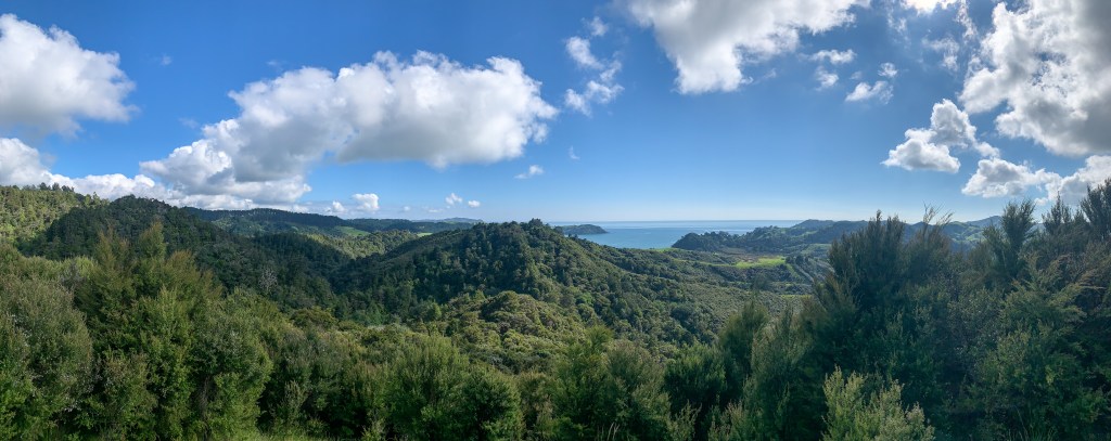
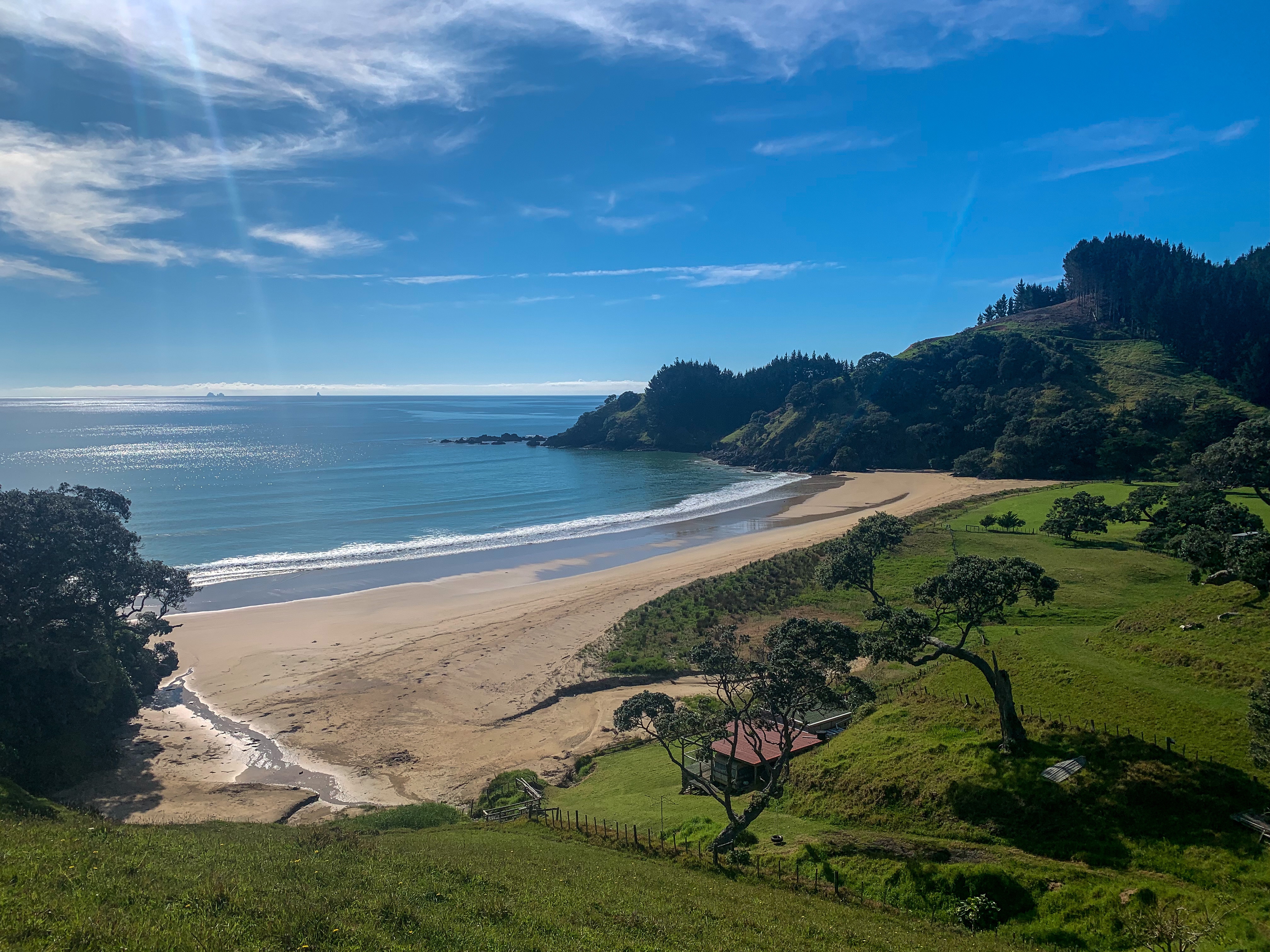
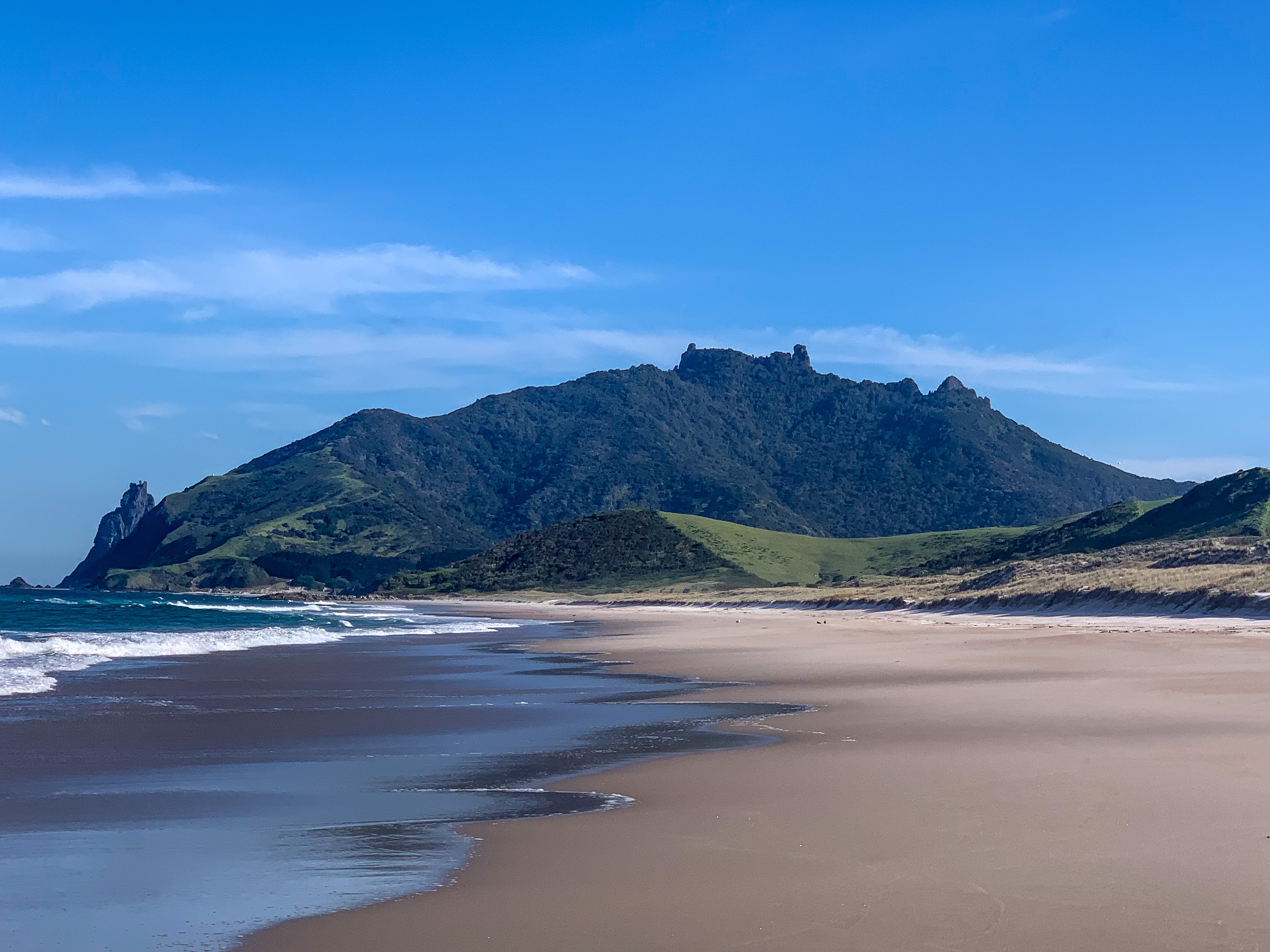
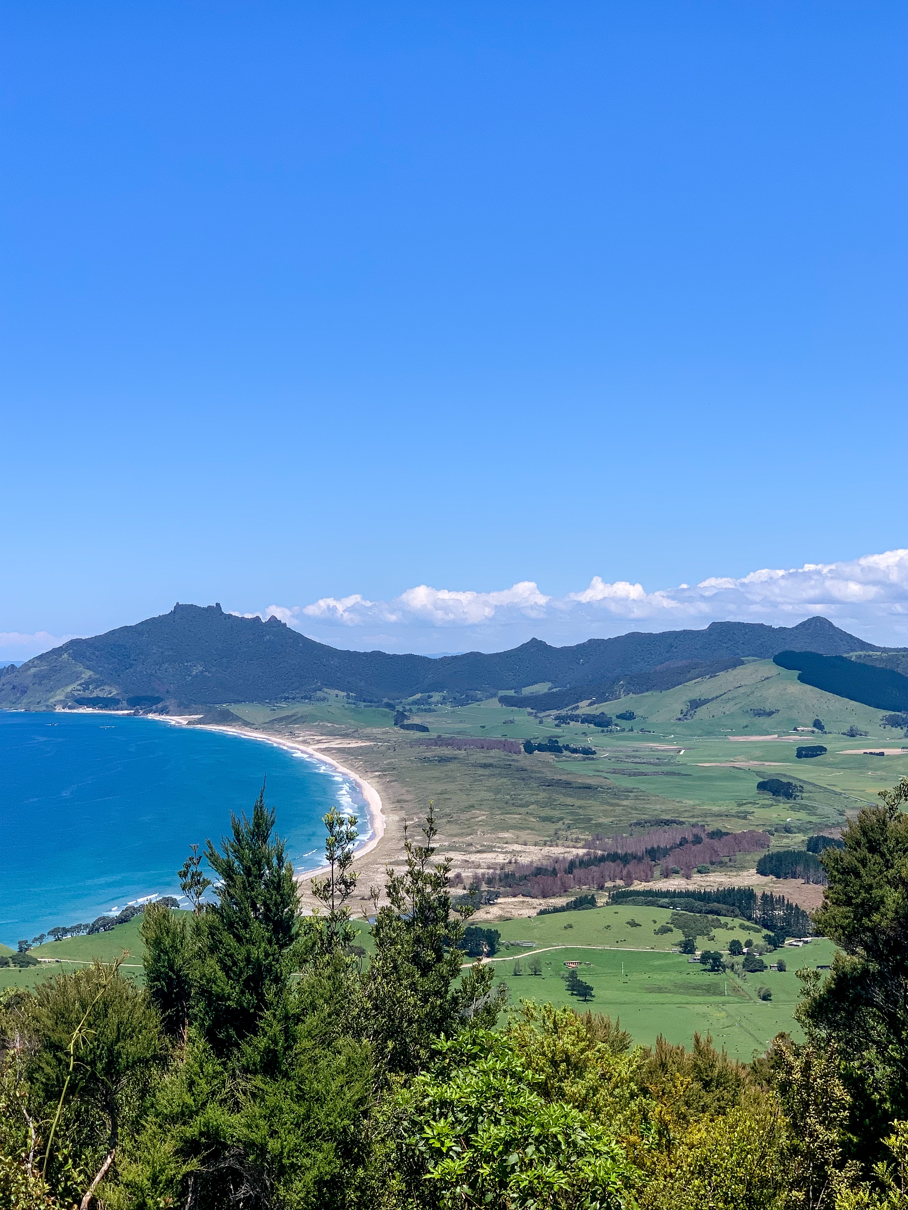
From here on it was another road detour to Kauri Mountain where I enjoyed a lunch time summit and perfect views across Ocean Beach gazing across to Bream Head. On the road again there were many opportunities to stop in the shade to dance to Taylor Swift ahead of her re-release Red album. I also got to ride on the back of a cone road worker vehicle for 500metres as they were resealing the road and didn’t want me to be injured. The days walk finished down the southern end of Ocean Beach at the base of Bream Head, ready for the Te Whara Track in the morning. Overall it was the best day on trail yet!

Tay tay celebration!

The next morning I awoke with the excitement of my last day on trail for a bit while I plan my further thru hiking journey. What I was really excited for was sleeping in my own bed, getting to wear clean clothes and go at least a day without eating a muesli bar or dry noodles (I definitely need to mix up my trail diet more).

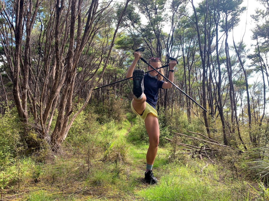
The trail from the southern end of Ocean Beach starts on the Te Whara/Bream Head Track with a steep grassy climb up to the WWII naval radar station and then onto Te Whara Summit. Here you have the option of climbing a boulder for a better lookout across Bream Bay and Whāngārei Harbour, a vantage point that in previous solo walks of this track I have never taken given my fear of heights. As I was walking with Nate on this occasion I very timidly scaled the boulder, but not without first getting covered in dirt from hugging the tree trunk on the way up.

The smile after the boulder climbing fear

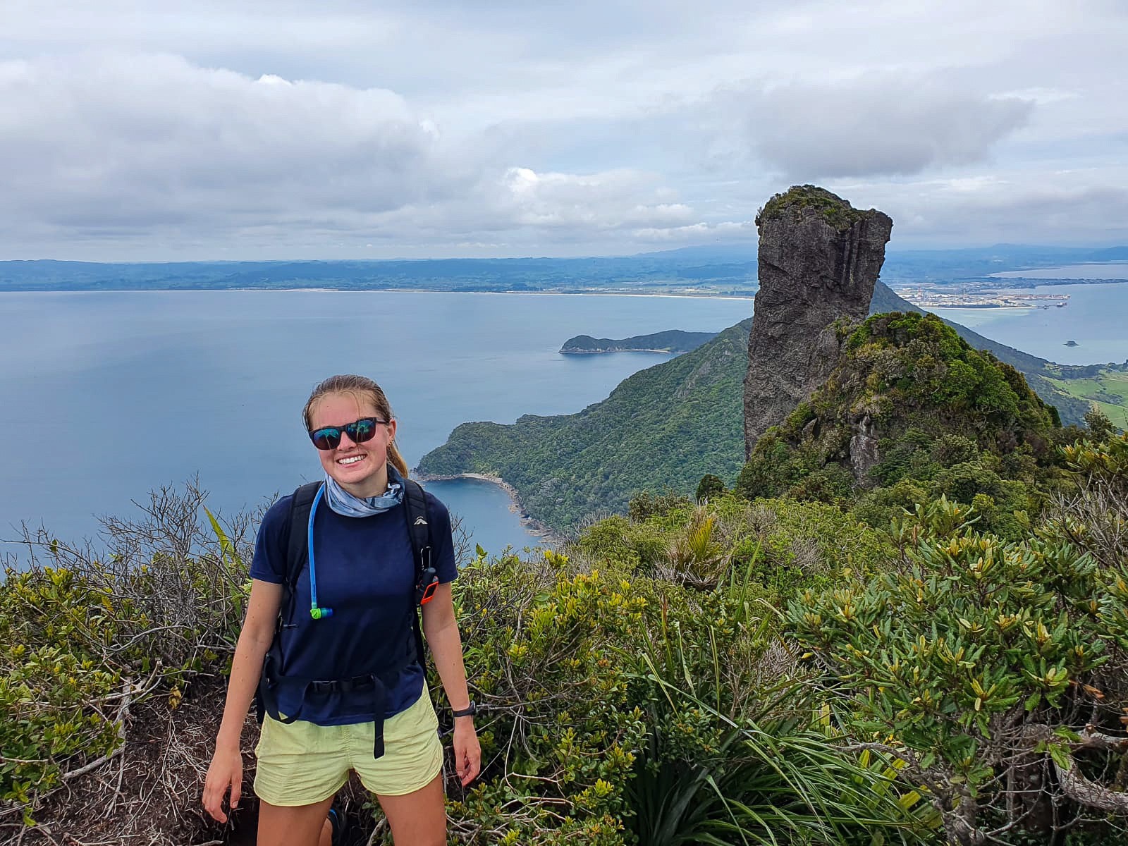
From here the track continues along the ridge-line and offers those wanting to walk 785 steps down and then back up again a route to Peach Cove (I’ve done this before and I was not going to be doing this again) or straight onto Matariki/Lion Summit. Nate left prior to the second summit ascend and warned me about the hundreds of steps to encounter on my descent. He wasn’t wrong. From Mt Lion/Matariki the stairs seem to be endless as you plummet straight down to Urquharts Bay. Glimpses of sandy beaches can be seen through the tree lines as you descend but I was more concerned about tripping and catapulting myself into a roly-poly to really appreciate any of this. A short walk through Busy Head track and onto Reotahi Track around Mt Aubrey completes the Whāngārei Heads section. While most people catch a water taxi across Little Munroe Bay at this point, I have the luxury of still living in Whāngārei with a man and a van who kindly picked me up and we went and ate pizza 😛

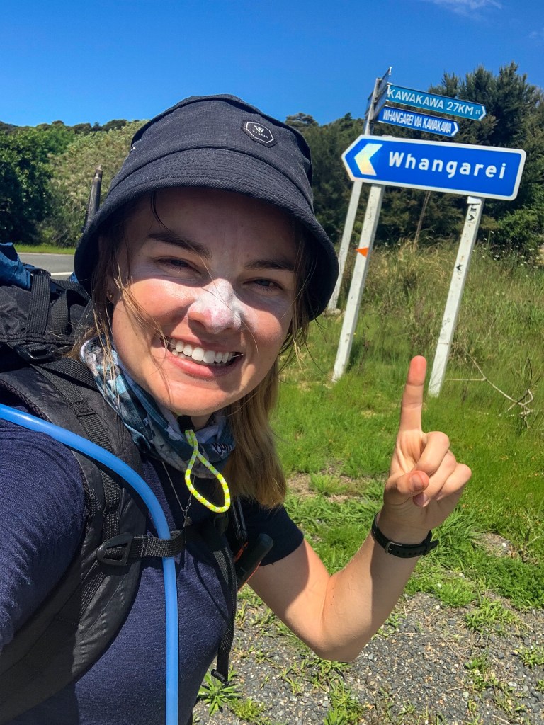
Due to on-going lockdown restrictions for the Auckland and Waikato sections of the TA trail, I plan on completing the Northland Forests section this week now that Northern Northland has re-opened and then who knows where to?

Helena Ridge Track lunch time antics.

Happy trotting everyone 🙂

Bay Of Islands

“I haven’t failed. I have just found 10,000 ways that won’t work”

Thomas Edison

Day 5 – 7

  • Day 5 – Puketi Forest HQ to Kerikeri ; 28km
  • Day 6 – Kerikeri to Paihia ; 23km
  • Day 7 – Paihia to Whangaruru ; 28km

Total hiked: 180 km


A thru hike is not easy to plan, especially in these unprecedented times… haha I sound very official don’t I, but seriously I would be lying if I thought my ‘ideal’ SOBO Te Araroa was to go exactly as planned this season. I just didn’t think I’d be scheduling a restart on day five.

Unfortunately as I hobbled my way off Ninety Mile Beach and into a shower, little did I know that in an hour I’d be clean but in a great escape from Northern Northland back to my home base in Whangarei and organising a restart. Thanks again Reuben for your car getaway expertise!

The pandemic early on was testing my flexibility, confidence and resilience in completing this thru-hike. Too easy would it have been with my bruised, swollen feet and sunburnt face to rest for days, turned weeks on end and await an ‘ideal’ time to restart the trail. But I don’t think there will ever be that time for this seasons TA hikers, instead flip flopping will be our norm.

So as it happened, I returned to trail two days later at the new lockdown border of Puketi Forest HQ and began the next part of my hike. Knowing that when the time was right (and the rest of Northland got out of lockdown) I’d return to the infamous Northland Forests and complete my journey.

Making a friend

My return to trail was a stark contrast to my departure, gone was the sand, winds and never ending beach, but a lass I was walking on gravel/dirt roads with livestock. What initially was quite and exciting to see all the cute cows and their friendly moos, quickly became frightening with their beady stares, herd like mentality and relentless noise. They never shut up! I’d walk past one farm to have every and I mean every cow approach the fence, follow me for the duration of their paddock, moo at the top of their lungs, some even rise onto their hind legs, all to reach the end and just glare at me. Only to have this ALL repeated at the very next paddock.

Curious Cows

I finally thought I’d reached salvation from the ‘curious cows’ when I saw the sign for Kerikeri as I was approaching state highway 10, only to accidentally slip on the road barrier and face plant into the asphalt. Fortunately I came away with only a grazed face, hands and bloody knee but learnt a very good lesson… state highways aren’t my friend.

The remainder of the walk into Kerikeri was great. Along the trail there are parts that I’ve previously completed and am looking forward to revisiting, Rainbow Falls to the Stonehouse was one of them. And to make it even better, Nate was able to join me for what turned into another rainy hike for the two of us.

Raining at Rainbow Falls

The following day I set off from the Stonehouse in Kerikeri and into Waitangi Forest, but not without a quick ‘how to safely walk on busy roads’ lesson from Nate. Very much appreciated after yesterday’s carfuffle. The forest provided some great views across the Bay of Islands and ample shade, which I would come the cherish in the days that followed. It also smelt piney which I mentioned aloud to myself far too many times. Towards the end of the forest I met back up with Nate and we climbed Mt Bledisloe together, it’s not on the trail but it is a pretty stunning view from the top! Slowly I made my way down the hill to trot through Waitangi and onto Paihia where we camped overnight.

Someone’s stoked about the view!

In the morning we parted ways once again and I set off this time on a ferry from Paihia to Russell, my favourite place in New Zealand (so far). Russell provides a lot of nostalgia for my family and I, from sailing trips, summer holidays and generations spent in this idealic seaside town I was very pleased to be back, for what was to be a very long and hot road walking day.

Russell Waterfront
The hot trot

Due to Kauri dieback, the beautiful Russell Forest has been closed and instead the trail takes you around a road route. What started as an meandering boardwalk through mangroves, quickly turned into a bustling road with no shade and scorching sun. My mantra of ‘trot trot trot’ which I chanted to keep myself motivated, changed to ‘hot hot hot’ rather accurately and later unintelligent moans as I felt the heat reflecting off the road and sizzling even up my nostrils.

When I made it to the turn off of Russell-Whakepara Road, through Ngaiotona Reserve and began to see all the magnificent Kauri trees I was reminded of an important life lesson and something I am really trying to work on during this trail. Its about the journey, not the destination. It’s important in everyday life to appreciate the small things, whether they help you achieve your goals or simply make you feel good, they’re all important and worth remembering. Because if you get to the end of walking the length of country and can’t remember the stunning scenery, people’s acts of kindness or the beautiful Kauri trees that provided you shade when you were sweltering then what have you really taken away from this experience. Just something to think about…

SHADE

Eventually I made it to Whangaruru and stayed at The Farm. The warm greeting, tour of their extensive property and friendly faces made me feel really welcome, especially Anna who took me on the tour and the two little sisters Mia and Jules who helped me pitch my tent. I highly recommend people stay here if they’re passing through.

I also saw a sign for Whāngārei today which was pretty cool.

Until next time, happy trotting!

Chuffed to see this sign and sun smart (thats important)

Ninety Mile Beach

“Then one day when you least expect it a great adventure finds you”

Ewan McGregor 

Day 1 – 4

  • Day 1 – Cape Reinga to Twilight Beach campsite ; 12km
  • Day 2 – Twilight Beach campsite to Maunganui Bluff campsite ; 28km
  • Day 3 – Maunganui Bluff campsite to Hukatere campsite ; 30km
  • Day 4 – Hukatere campsite to Ahipara ; 31km

Total hiked: 101 km


Wow. How to describe starting Te Araroa… 

Scratch that, how to describe a great adventure that you’ve spent years thinking about,months planning and weeks leading to the big start date uncertain whether your town would suddenly go back into lockdown.

Yeah, Te Araroa this year won’t be like any other. Mix a delta variant pandemic into a through-hike and you’ve got a lot of empty campsites, flip flopping hikers and friendly waves with locals at a two metre distance. 

As most people who imagine one day walking Te Araroa I started true to the trail, from the top in Cape Reinga. 

Unfortunately, what is usually a popular time to start the hike in late October was not the case this year and only I started that week on Saturday October 29th. Fortunately, my partner knowing this to be my first overnight hike (there’ll be many to come haha) and the nerves I’d developed very, very, very kindly offered to walk the first day and stay overnight with me at Twilight Beach. 

We started from Cape Reinga/Te Rerenga Wairua late in the afternoon and headed down the infamous stairs to Te Werahi beach.

Due to high tide antics, rock climbing and thigh deep water stream crossings quickly became our norm, we made it to Twilight/Paengarehia beach campsite saturated but in one piece! 

The rain and wind continued overnight and gave my new tent a real test for durability, which very thankfully it passed. Late in the morning we set out from our micro campsite to Scott Point/Tiriparepa where we were parting ways and I was continuing my adventure solo. Not without a quick karate photo first though 😛 

From here I placed the first of many (many many) foot steps on Ninety Mile Beach/Te Oneroa-a-Tohe.

Over the course of the next three days I walked down the beach, waved at local fisherman, got rained on intermittently, danced to my appropriately named ‘Trail Mix’ playlist, developed these rather cool sunburn/windburn high sock tan lines, wore a rain jacket for rain, sun and strong southerly wind protection and had only a few meltdowns at how much further I had to walk along the sand. 

In particular, day four turned out to be a shocker for relentless sun and south westerly winds all without anywhere to hide and protect your skin from the burning, pelting sand. It actually made me miss the rain! Needless to say the evolution of my outfit over the course of the final day was quite something…

While staying in Hukatere campsite the delightful owner Gabriela told me of how her and her late husband had been involved in the construction of the first in-hospital marae in Kaitaia, she even carved her initials in the corner to remember it for years to come – definitely worth a visit if you’re in the area. 

Whilst no other hikers joined me at any subsequent campsites it did offer ample time to read my books (good thing I bought the kindle) and write my blog 🙂 

Mid Tuesday afternoon I walked (more like hobbled) into Ahipara and was greeted by the two lovely faces of Jules and John, I don’t know whether it was the shower or two people to talk to that I treasured more but thank-you.

I passed 100km hiked whilst on the beach, just 2900km left to go!

Gear

“I haven’t met the new me yet”

Taylor Swift – Happiness

While I haven’t met the new me yet but I have met my new gear for Te Araroa trail and now so can you. 🙂

Below is all the gear I will be starting at Cape Reinga with and a link to the weights of individual items in my pack.

https://lighterpack.com/r/7p120u


Disclaimer – by no means am I an expert as to what is best to pack, worth spending money on or what is silly and considered a waste carrying (I know your thinking this about the pineapple shirt) but this is what I have decided to start with.

Also, I have purchased all of these items myself – no brand affiliation, sponsorship or gifting has occurred… but if you’re really keen to have me wear/use something of yours then let me know, Patagonia I am talking to you!

Let’s be honest, I probably won’t finish with this exact contents but I’ve decided that this hike will be a learning experience for both myself and my pack contents.

Bridges

“We build too many walls and not enough bridges”

Isaac Newton

Why you might ask I have a post specifically about bridges? 

Well firstly great question.

Secondly I love bridges!!!

Need I say more.

Through researching Te Araroa trail I find a lot of people take pictures of the kilometres they walk, back country huts they stay at and weird meals they eat. While that’s all well and good, I like bridges, scratch that love bridges, so I will be taking pictures of them (and probably the former mentioned things too since that also sounds fun) but be sure there will not be a bridge I cross that I don’t tell you about.

And by you I mean my parents and Nate reading this blog – since who else is actually reading this.

chuffed on a bridge

Te Araroa Trail

Aotearoa’s 3000km thru hike from Cape Reinga to Bluff


5 years ago I travelled to the South Island of New Zealand for the first time. 

The reason I was there was to see all the ‘Big Things of NZ‘ but thats a different story, anyway whilst sight-seeing everything that Bluff had to offer a muddy, sweaty backpacker asked if I could take her picture in front of the Bluff signpost. She was so elated to have made it that I asked her why? Te Araroa was her response and I have been curious ever since. 

My journey in deciding to walk Te Araroa has been much like the trail itself – long.

Amongst finishing my studies, moving, starting work, pausing work, moving and re-starting work again, all whilst struggling with mental illness and loss, I have come to the decision if not now when? and so my planning to walk Te Araroa began! Throw in a pandemic and you’ve got the whole shebang.

Mum and I at Bluff signpost 2017

I plan to start in October-November of 2021 walking in the SOBO direction or from Cape Reinga to Bluff for those not yet down with the hiking lingo (weather and tide dependent since you start the walk along Ninety Mile Beach and I don’t want to be washed away my first day, that wouldn’t equal longevity for the walk or my blog).

While I am starting the walk solo, I hope to make friends along the way but would also love to see a friendly face – so join me! Send a text, call, facebook message, email, carrier pigeon, whatever and I will get back to you (reception and cellphone battery life dependent) 

And if you just want to know more about the trail click here…. or here

“I hope you live a life you’re proud of and if you find that you’re not, I hope you have the strength to start all over again”

F. S. Fitzgerald